The Himalayas
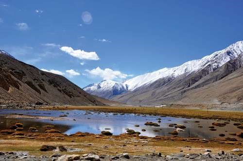
The Himalayas (from the Sanskrit words hima, “snow,” and alaya, “abode”), the loftiest mountain system in the world, form the northern limit of India. That great, geologically young mountain arc is about 1,550 miles (2,500 km) long, stretching from the peak of Nanga Parbat (26,660 feet [8,126 metres]) in the Pakistani-administered portion of the Kashmir region to the Namcha Barwa peak in the Tibet Autonomous Region of China. Between those extremes the mountains fall across India, southern Tibet, Nepal, and Bhutan. The width of the system varies between 125 and 250 miles (200 and 400 km).
Within India the Himalayas are divided into three longitudinal belts, called the Outer, Lesser, and Great Himalayas. At each extremity there is a great bend in the system’s alignment, from which a number of lower mountain ranges and hills spread out. Those in the west lie wholly within Pakistan and Afghanistan, while those to the east straddle India’s border with Myanmar (Burma). North of the Himalayas are the Plateau of Tibet and various Trans-Himalayan ranges, only a small part of which, in the Ladakh region of Jammu and Kashmir state (in the Indian-administered portion of Kashmir), are within the territorial limits of India.
HimalayasPortion of the Himalayas in Jammu and Kashmir, India.© jayk67/Fotolia.
Because of the continued subduction of the Indian peninsula against the Eurasian Plate, the Himalayas and the associated eastern ranges remain tectonically active. As a result, the mountains are still rising, and earthquakes—often accompanied by landslides—are common. Several since 1900 have been devastating, including one in 1934 in what is now Bihar state that killed more than 10,000 people. In 2001 another tremor (the Bhuj earthquake), farther from the mountains, in Gujarat state, was less powerful but caused extensive damage, taking the lives of more than 20,000 people and leaving more than 500,000 homeless. Still others—notably the 2005 quake in Pakistani-administered Kashmir and the 2015 temblor in Nepal—principally affected those regions but also caused widespread damage and hundreds of deaths in adjacent parts of India. The relatively high frequency and wide distribution of earthquakes likewise have generated controversies about the safety and advisability of several hydroelectric and irrigation projects.
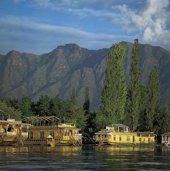
Srinagar, Jammu and Kashmir, India: Nagin LakeHouseboats along the shore of Nagin Lake, Srinagar, Jammu and Kashmir, India.Gerald Cubitt.
The Outer Himalayas (the Siwalik Range)
The southernmost of the three mountain belts are the Outer Himalayas, also called the Siwalik (or Shiwalik) Range. Crests in the Siwaliks, averaging from 3,000 to 5,000 feet (900 to 1,500 metres) in elevation, seldom exceed 6,500 feet (2,000 metres). The range narrows as it moves east and is hardly discernible beyond the Duars, a plains region in West Bengal state. Interspersed in the Siwaliks are heavily cultivated flat valleys (duns) with a high population density. To the south of the range is the Indo-Gangetic Plain. Weakly indurated, largely deforested, and subject to heavy rain and intense erosion, the Siwaliks provide much of the sediment transported onto the plain.
The Lesser Himalayas
To the north of the Siwaliks and separated from them by a fault zone, the Lesser Himalayas (also called the Lower or Middle Himalayas) rise to heights ranging from 11,900 to 15,100 feet (3,600 to 4,600 metres). Their ancient name is Himachal (Sanskrit: hima, “snow,” and acal, “mountain”). The mountains are composed of both ancient crystalline and geologically young rocks, sometimes in a reversed stratigraphic sequence because of thrust faulting. The Lesser Himalayas are traversed by numerous deep gorges formed by swift-flowing streams (some of them older than the mountains themselves), which are fed by glaciers and snowfields to the north.
Srinagar, Jammu and Kashmir, India: Nagin LakeHouseboats along the shore of Nagin Lake, Srinagar, Jammu and Kashmir, India.Gerald Cubitt.
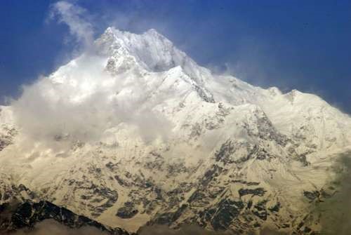
The Great Himalayas
The northernmost Great, or Higher, Himalayas (in ancient times, the Himadri), with crests generally above 16,000 feet (4,900 metres) in elevation, are composed of ancient crystalline rocks and old marine sedimentary formations. Between the Great and Lesser Himalayas are several fertile longitudinal vales; in India the largest is the Vale of Kashmir, an ancient lake basin with an area of about 1,700 square miles (4,400 square km). The Great Himalayas, ranging from 30 to 45 miles (50 to 75 km) wide, include some of the world’s highest peaks.
KanchenjungaKanchenjunga, the world’s third highest mountain, in the Great Himalayas on the border between Nepal and Sikkim state, India.© saps/Fotolia.
Associated ranges and hills
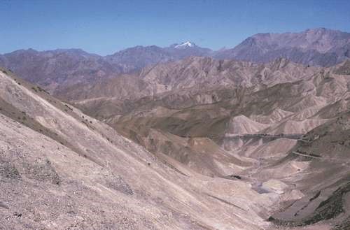
In general, the various regional ranges and hills run parallel to the Himalayas’ main axis. Those are especially prominent in the northwest, where the Zaskar Range and the Ladakh and Karakoram ranges (all in Jammu and Kashmir state) run to the northeast of the Great Himalayas. Also in Jammu and Kashmir is the Pir Panjal Range, which, extending along the southwest of the Great Himalayas, forms the western and southern flanks of the Vale of Kashmir.
India: Ladakh mountain rangeBarren mountains of Ladakh, India.Courtesy of Iffat Fatima.
The Great Himalayas
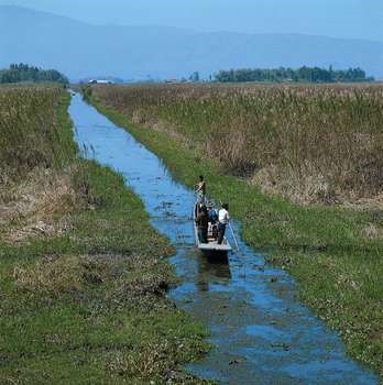
At its eastern extremity, the Himalayas give way to a number of smaller ranges running northeast-southwest—including the heavily forested Patkai Range and the Naga and Mizo hills—which extend along India’s borders with Myanmar and the southeastern panhandle of Bangladesh. Within the Naga Hills, the reedy Logtak Lake, in the Manipur River valley, is an important feature. Branching off from those hills to the northwest are the Mikir Hills, and to the west are the Jaintia, Khasi, and Garo hills, which run just north of India’s border with Bangladesh. Collectively, the latter group is also designated as the Shillong (Meghalaya) Plateau.
Imphal, Manipur, India: canal near Logtak LakeBoatman on a canal south of Logtak Lake, near Imphal, Manipur, India.Gerald Cubitt.
The highest in the range, Mount Everest (at 29,035 feet [8,850 metres]; see Researcher’s Note: Height of Mount Everest), is on the China-Nepal border, but India also has many lofty peaks. Notable among those is Kanchenjunga (28,169 feet [8,586 metres]) on the border of Nepal and the state of Sikkim, which is the world’s third tallest peak and India’s highest point. Other high mountains in India include Nanda Devi (25,646 feet [7,817 metres]), Kamet (25,446 feet [7,755 metres]), and Trisul (23,359 feet [7,120]) in Uttarakhand. The Great Himalayas lie mostly above the line of perpetual snow and thus contain most of the Himalayan glaciers.
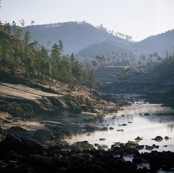
Shillong, Meghalaya, India: southern hillsidesMorning mist and frosty hillsides south of Shillong, Meghalaya, India.Gerald Cubitt.
The Indo-Gangetic Plain
The second great structural component of India, the Indo-Gangetic Plain (also called the North Indian Plain), lies between the Himalayas and the Deccan. The plain occupies the Himalayan foredeep, formerly a seabed but now filled with river-borne alluvium to depths of up to 6,000 feet (1,800 metres). The plain stretches from the Pakistani provinces of Sindh and Punjab in the west, where it is watered by the Indus River and its tributaries, eastward to the Brahmaputra River valley in Assam state.
The Ganges (Ganga) River basin (in India, mainly in Uttar Pradesh and Bihar states) forms the central and principal part of the plain. The eastern portion is made up of the combined delta of the Ganges and Brahmaputra rivers, which, though mainly in Bangladesh, also occupies a part of the adjacent Indian state of West Bengal. That deltaic area is characterized by annual flooding attributed to intense monsoon rainfall, an exceedingly gentle gradient, and an enormous discharge that the alluvium-choked rivers cannot contain within their channels. The Indus River basin, extending west from Delhi, forms the western part of the plain; the Indian portion is mainly in the states of Haryana and Punjab.
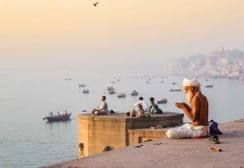
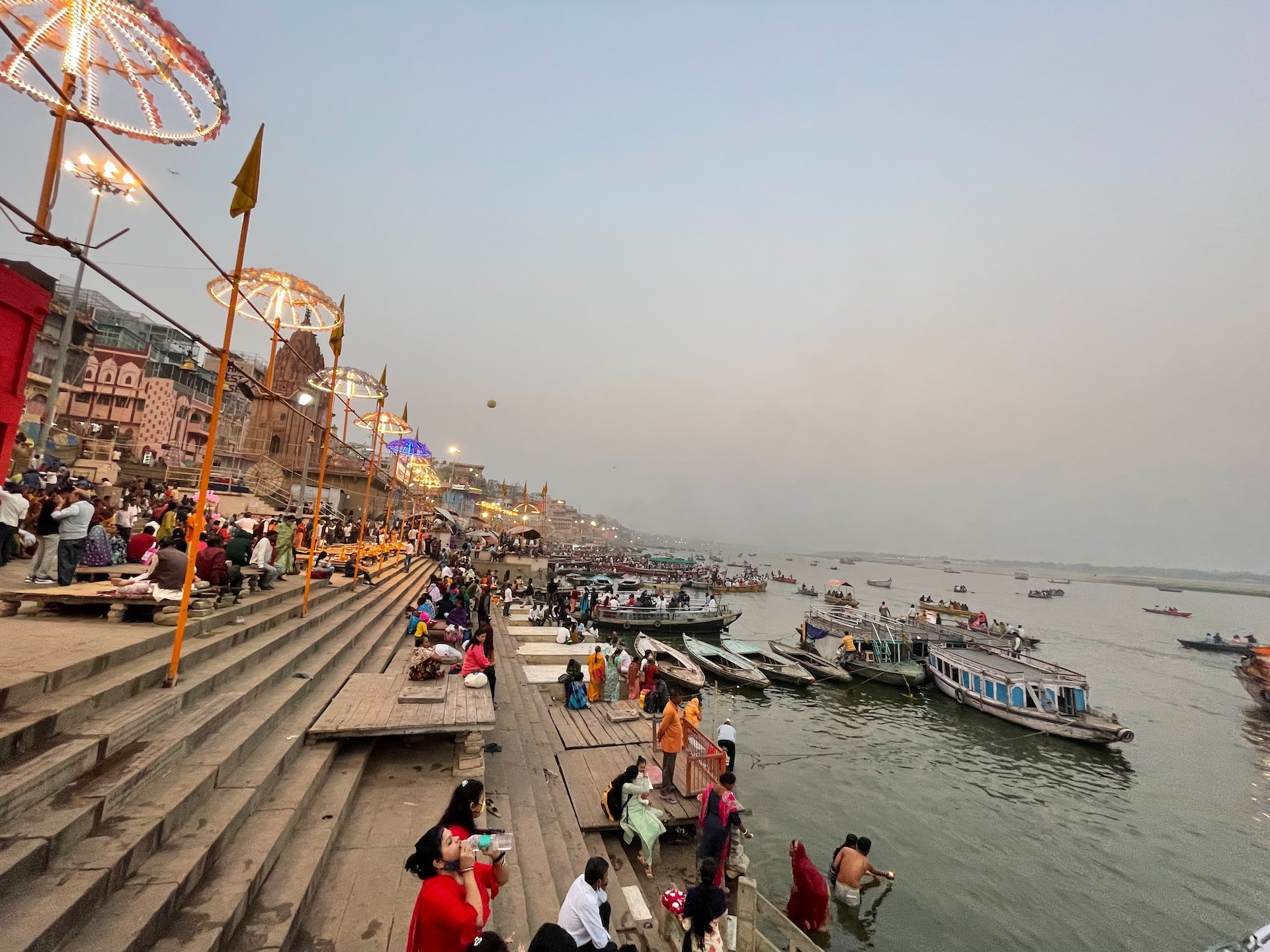
Varanasi, India: Ganges RiverMorning prayers along the Ganges River, Varanasi, India.© Jedraszak/iStock.com.
The overall gradient of the plain is virtually imperceptible, averaging only about 6 inches per mile (95 mm per km) in the Ganges basin and slightly more along the Indus and Brahmaputra. Even so, to those who till its soils, there is an important distinction between bhangar—the slightly elevated, terraced land of older alluvium—and khadar, the more fertile fresh alluvium on the low-lying floodplain. In general, the ratio of bhangar areas to those of khadar increases upstream along all major rivers. An exception to the largely monotonous relief is encountered in the southwestern portion of the plain, where there are gullied badlands centring on the Chambal River. That area has long been famous for harbouring violent gangs of criminals called dacoits, who find shelter in its many hidden ravines.
The Great Indian, or Thar, Desert forms an important southern extension of the Indo-Gangetic Plain. It is mostly in northwestern India but also extends into eastern Pakistan and is mainly an area of gently undulating terrain, and within it are several areas dominated by shifting sand dunes and numerous isolated hills. The latter provide visible evidence of the fact that the thin surface deposits of the region, partially alluvial and partially wind-borne, are underlain by the much older Indian-Australian Plate, of which the hills are structurally a part.
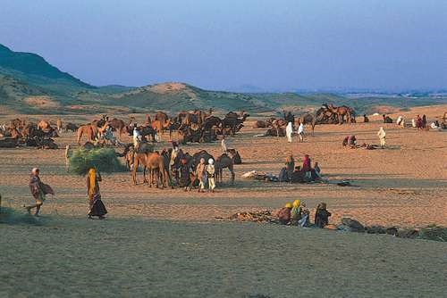
Pushkar, Rajasthan, India: Hindu pilgrimsHindu pilgrims gathering at Pushkar in the Great Indian Desert (Thar Desert), Rajasthan, India.© Brian A. Vikander/West Light.
The Deccan
The remainder of India is designated, not altogether accurately, as either the Deccan plateau or peninsular India. It is actually a topographically variegated region that extends well beyond the peninsula—that portion of the country lying between the Arabian Sea and the Bay of Bengal—and includes a substantial area to the north of the Vindhya Range, which has popularly been regarded as the divide between Hindustan (northern India) and the Deccan (from Sanskrit dakshina, “south”).
Having once constituted a segment of the ancient continent of Gondwana, that land is the oldest and most geologically stable in India. The plateau is mainly between 1,000 and 2,500 feet (300 to 750 metres) above sea level, and its general slope descends toward the east. A number of the hill ranges of the Deccan have been eroded and rejuvenated several times, and only their remaining summits testify to their geologic past. The main peninsular block is composed of gneiss, granite-gneiss, schists, and granites, as well as of more geologically recent basaltic lava flows.
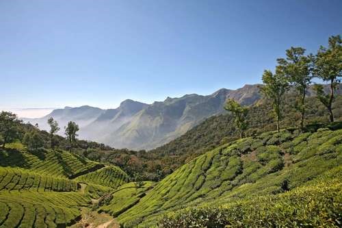
Kerala, India: tea plantationTea plantation in the foothills of the Western Ghats, Deccan region, Kerala, India.© michel Hasson/Fotolia.
The Western Ghats
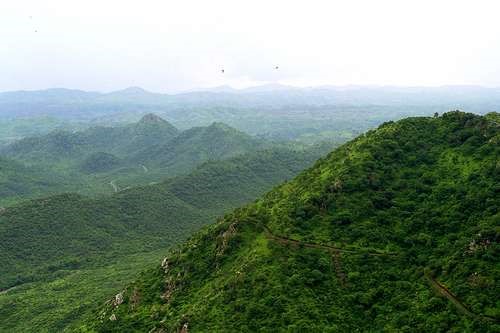
The Western Ghats, also called the Sahyadri, are a north-south chain of mountains or hills that mark the western edge of the Deccan plateau region. They rise abruptly from the coastal plain of the Arabian Sea as an escarpment of variable height, but their eastern slopes are much more gentle. The Western Ghats contain a series of residual plateaus and peaks separated by saddles and passes. The hill station (resort) of Mahabaleshwar, located on a laterite plateau, is one of the highest elevations in the northern half, rising to 4,700 feet (1,430 metres). The chain attains greater heights in the south, where the mountains terminate in several uplifted blocks bordered by steep slopes on all sides. Those include the Nilgiri Hills, with their highest peak, Doda Betta (8,652 feet [2,637 metres]); and the Anaimalai, Palni, and Cardamom hills, all three of which radiate from the highest peak in the Western Ghats, Anai Peak (Anai Mudi, 8,842 feet [2,695 metres]). The Western Ghats receive heavy rainfall, and several major rivers—most notably the Krishna (Kistna) and the two holy rivers, the Godavari and the Kaveri (Cauvery)—have their headwaters there.
Western Ghats, Tamil Nadu, India: Anaimalai HillsVillage in the Anaimalai Hills, Western Ghats, Tamil Nadu state, India.Gerald Cubitt.
The Eastern Ghats
The Eastern Ghats are a series of discontinuous low ranges running generally northeast-southwest parallel to the coast of the Bay of Bengal. The largest single sector—the remnant of an ancient mountain range that eroded and subsequently rejuvenated—is found in the Dandakaranya region between the Mahanadi and Godavari rivers. That narrow range has a central ridge, the highest peak of which is Arma Konda (5,512 feet [1,680 metres]) in northeastern Andhra Pradesh state. The hills become subdued farther southwest, where they are traversed by the Godavari River through a gorge 40 miles (65 km) long. Still farther southwest, beyond the Krishna River, the Eastern Ghats appear as a series of low ranges and hills, including the Erramala, Nallamala, Velikonda, and Palkonda. Southwest of the city of Chennai (Madras), the Eastern Ghats continue as the Javadi and Shevaroy hills, beyond which they merge with the Western Ghats.
Inland regions
The northernmost portion of the Deccan may be termed the peninsular foreland. That large ill-defined area lies between the peninsula proper to the south (roughly demarcated by the Vindhya Range) and the Indo-Gangetic Plain and the Great Indian Desert (beyond the Aravalli Range) to the north.
The Aravalli (or Aravali) Range runs southwest-northeast for more than 450 miles (725 km) from a highland node near Ahmadabad, Gujarat, northeast to Delhi. Those mountains are composed of ancient rocks and are divided into several parts, in one of which lies Sambhar Salt Lake. Their highest summit is Guru Peak (5,650 feet [1,722 metres]), on Mount Abu. The Aravallis form a divide between the west-flowing streams, draining into the desert or the Rann of Kachchh (Kutch), and the Chambal and its tributaries within the Ganges River catchment area.
Between the Aravallis and the Vindhya Range lies the fertile, basaltic Malwa Plateau. The plateau gradually rises southward toward the hills of the Vindhya Range, which is actually a south-facing escarpment deeply eroded by short streams flowing into the valley of the Narmada River below. The escarpment appears from the south as an imposing range of mountains. The Narmada valley forms the western and principal portion of the Narmada-Son trough, a continuous depression running southwest-northeast, mostly at the base of the Vindhya Range, for about 750 miles (1,200 km).
Most of the inland area south of the peninsular foreland and the Chota Nagpur plateau is characterized by rolling terrain and generally low relief, within which a number of hill ranges, some of them mesalike formations, run in various directions. Occupying much of the northwestern portion of the peninsula (most of Maharashtra and some bordering areas of Madhya Pradesh, Telangana, and Karnataka) is the Deccan lava plateau. The mesa-like features are especially characteristic of that large fertile area, which is cut across by the Satpura, Ajanta, and Balaghat ranges.
To the east of the peninsular foreland lies the mineral-rich Chota Nagpur plateau region (mostly within Jharkhand, northwestern Odisha [Orissa], and Chhattisgarh states). It is a region of numerous scarps separating areas of rolling terrain. To the southwest of the Chota Nagpur plateau is the Chhattisgarh Plain, centred in Chhattisgarh on the upper course of the Mahanadi River.
The Eastern Ghats
The Eastern Ghats are a series of discontinuous low ranges running generally northeast-southwest parallel to the coast of the Bay of Bengal. The largest single sector—the remnant of an ancient mountain range that eroded and subsequently rejuvenated—is found in the Dandakaranya region between the Mahanadi and Godavari rivers. That narrow range has a central ridge, the highest peak of which is Arma Konda (5,512 feet [1,680 metres]) in northeastern Andhra Pradesh state. The hills become subdued farther southwest, where they are traversed by the Godavari River through a gorge 40 miles (65 km) long. Still farther southwest, beyond the Krishna River, the Eastern Ghats appear as a series of low ranges and hills, including the Erramala, Nallamala, Velikonda, and Palkonda. Southwest of the city of Chennai (Madras), the Eastern Ghats continue as the Javadi and Shevaroy hills, beyond which they merge with the Western Ghats.
Havelock IslandBeach resort on Havelock Island, Andaman and Nicobar Islands, India.© Lukas Hlavac/Fotolia.
Coastal areas
Most of the coast of India flanks the Eastern and Western Ghats. In the northwest, however, much of coastal Gujarat lies to the northwest of the Western Ghats, extending around the Gulf of Khambhat (Cambay) and into the salt marshes of the Kathiawar and Kachchh (Kutch) peninsulas. Those tidal marshes include the Great Rann of Kachchh along the border with Pakistan and the Little Rann of Kachchh between the two peninsulas. Because the level of the marshes rises markedly during the rainy season, the Kachchh Peninsula normally becomes an island for several months each year.
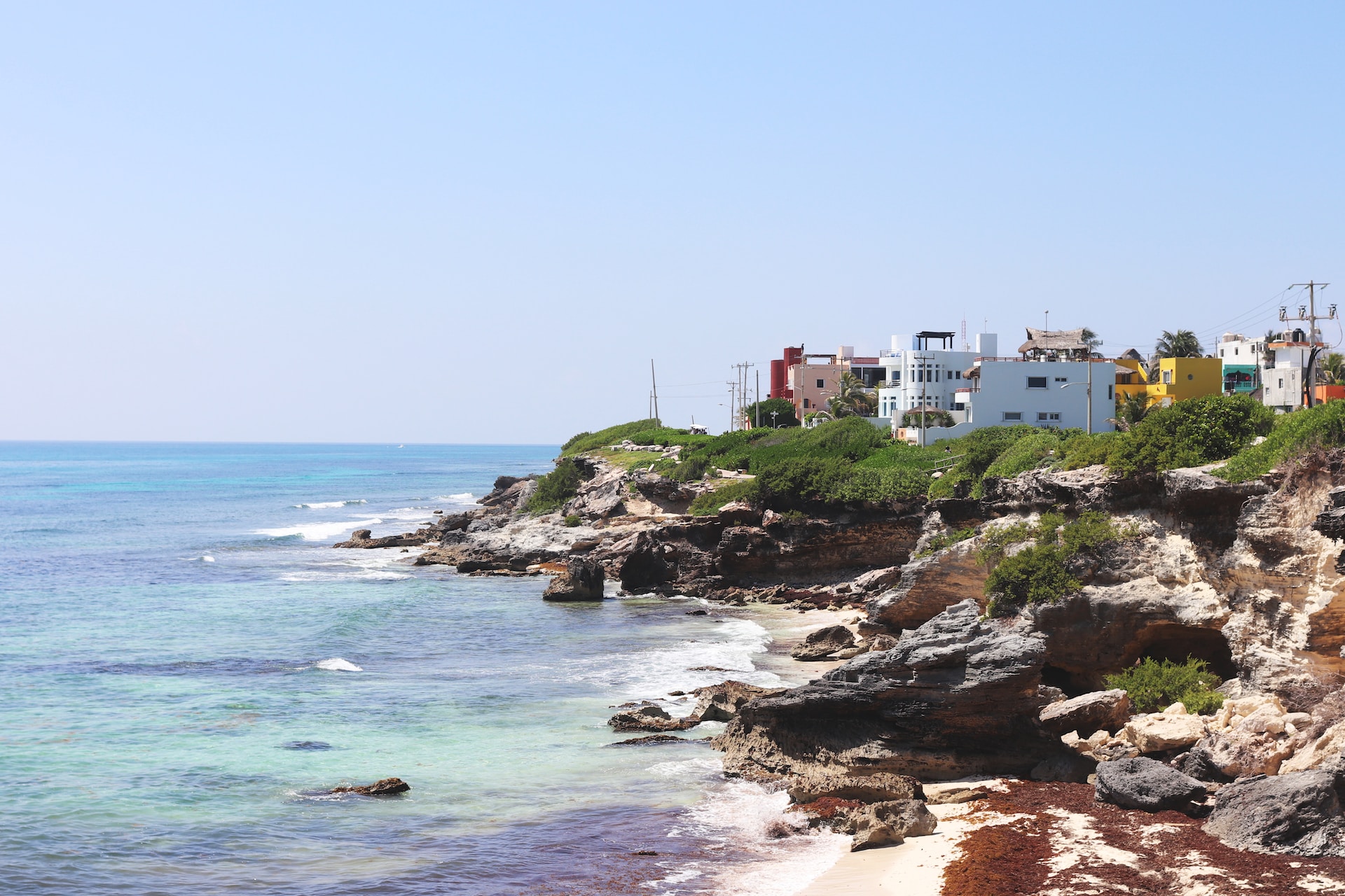
The area farther south, especially the stretch from Daman to Goa (known as the Konkan coast), is indented with rias (flooded valleys) extending inland into narrow riverine plains. Those plains are dominated by low-level lateritic plateaus and are marked by alternating headlands and bays, the latter often sheltering crescent-shaped beaches. From Goa south to Cape Comorin (the southernmost tip of India) is the Malabar coastal plain, which was formed by the deposition of sediment along the shoreline. The plain, varying between 15 and 60 miles (25 to 100 km) wide, is characterized by lagoons and brackish, navigable backwater channels.
The predominantly deltaic eastern coastal plain is an area of deep sedimentation. Over most of its length it is considerably wider than the plain on the western coast. The major deltas, from south to north, are of the Kaveri, the Krishna-Godavari, the Mahanadi, and the Ganges-Brahmaputra rivers. The last of those is some 190 miles (300 km) wide, but only about one-third of it lies within India. Traversed by innumerable distributaries, the Ganges delta is an ill-drained region, and the western part within Indian territory has become moribund because of shifts in the channels of the Ganges. Tidal incursions extend far inland, and any small temporary rise in sea level could submerge Kolkata (Calcutta), located about 95 miles (155 km) from the head of the Bay of Bengal. The eastern coastal plain includes several lagoons, the largest of which, Pulicat and Chilka (Chilika) lakes, have resulted from sediment being deposited along the shoreline.
Islands
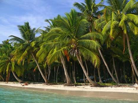
Several archipelagoes in the Indian Ocean are politically a part of India. The union territory of Lakshadweep is a group of small coral atolls in the Arabian Sea to the west of the Malabar Coast. Far off the eastern coast, separating the Bay of Bengal and the Andaman Sea, lie the considerably larger and hillier chains of the Andaman and Nicobar Islands, also a union territory; the Andamans are closer to Myanmar and the Nicobars closer to Indonesia than to the Indian mainland.